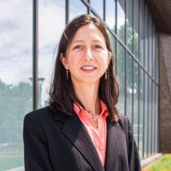
Biography
Samantha Jones teaches a range of GIS and physical geography courses in the Center for Sustainability Studies. Prior to joining BSU in the fall of 2014, she worked for several years in forest research and management with federal, state, and county agencies. Sam draws from the extensive field and GIS experiences provided by these opportunities to integrate practical concepts and applications into her coursework.
A rural northern Minnesota native, Sam began her academic path in geography and GIS at Itasca Community College and went on to complete the Bachelor of Science in Geography with GIS emphasis at BSU. She earned a Master of Science in Geography at Ohio University in 2013. The path of geography led to many interesting and rewarding adventures: sampling old growth red pine forests in the Boundary Waters Canoe Area Wilderness, studying sacred forests in the North Pare Mountains of Tanzania, and exploring Buddhist temples in the Kingdom of Bhutan are among the highlights.
Degrees
- Doctor of Education, Winona State University, 2021
- Master of Science, Geography, Ohio University, 2013
- Bachelor of Science, Geography/GIS, Biology Minor, Bemidji State University, 2011
- Professional Certificate in GIS, Itasca Community College, 2007
Teaching
Fall Semesters
- GEOG 3231/5231 Intro to GIS
- GEOG 3232/5232 Intermediate GIS
- GEOG 4130/5130 Biogeography
- GEOG 4140/5140 Landscape Ecology
Spring Semesters
- GEOG 2100 Intro to Physical Geography
- GEOG 3231/5231 Intro to GIS
- GEOG 3232/5232 Intermediate GIS
Research Interests
Owing to her passion for trees and forests, Sam established the BSU Tree Ring Lab in 2015 to assist regional forest managers with the dendrochronological aspects of addressing forest management issues. The history of a tree as told in its growth rings can be quite enlightening! Sam’s recent work is focused on drought response in managed conifer forests in collaboration with the USFS Northern Research Station, and the habitat selection patterns of cavity nesting wildlife with MN DNR.
Recent Work
2024 Jones, S., Bottero, A., Palik, B.. White spruce, drought, and spruce budworm: Can density management mitigate growth declines? Manuscript in preparation.
2024 North, M., Jones, S., Mehmel, G.. Quaking aspen ages to attain diameter thresholds for cavity-nesting wildlife. Manuscript in preparation.
Jones, S.. (2021). Educating for Sustainable Forestry: Perspectives on the Career Readiness of New Professionals. Winona State University Education Doctorate Dissertations. 4.
Westbrooks, D., Guillaume, N., Jones, S., De La Fosse, K.. (2020). Academic residency: Effective engagement and mentorship of doctoral students. Journal of College Teaching and Learning (TLC), 17(1), 1-10.
Holmes, B., Boulton, B., Boysen, B., Perry, C. L., Bailey, D., Durnen, A., Mollner, J., De La Fosse, K., Sinning, M. W., Guillaume, N., Breuninger, R., Jones, S., Webber, S.. (2019) Doctoral student perspectives on motivation and persistence: Eye-opening insights into the ideas and thoughts that today’s doctoral students have about finishing the doctoral degree. Education Doctorate Books. 1.
Jones, S., Bottero, A., Kastendick, D., Palik, B.. (2019). Managing red pine stand structure to mitigate drought impacts. Dendrochronologia, 10th World Dendro Commemorative Issue.
Fraver, S., Gentry, C., Bialecki, M., Brown, J., Brown, S., Jones, S., Kelly, K., Pansing, E., Stine, A., Thronton, M., Tucker, C.. (2015) Seeing the forest and the trees: Stand dynamics of Beech Mountain in Acadia National Park, Maine. 25th Annual North American Dendroecological Fieldweek (NADEF) NSF BCS #1061808.

